I’ve recently been adding some trail markers on public footpaths, a week ago I added some on the public right of way on a private estate. It looks like the landowner sent a request to have the wayspots removed - fair enough - however several key wayspots in the nearby village were also removed, these are not part of that estate.
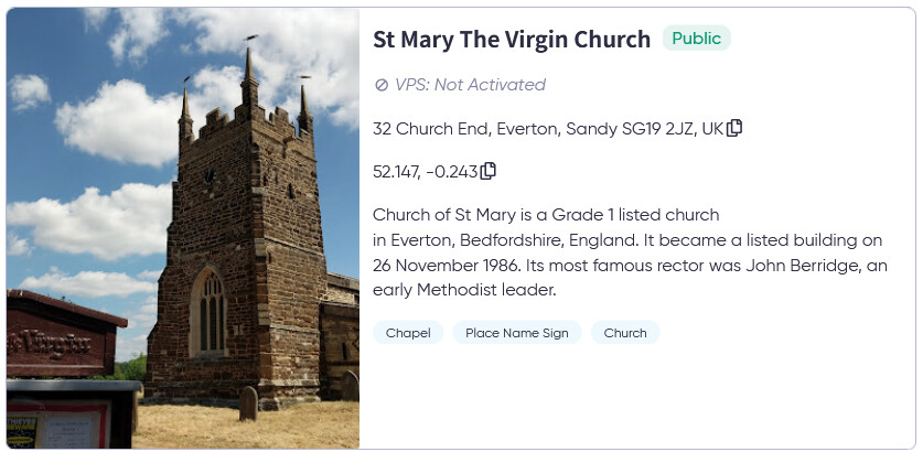
St Mary The Vn Church* (would you believe I can’t post the “V” word so image below)
52.146803, -0.243076
Everton Village Hall
52.146386, -0.244255
Everton War Memorial
52.147161, -0.24267999999999998
Greensand Ridge Walk trail marker
52.146772, -0.24361
Everton Parish Noticeboard
52.146722, -0.243445
North Beds Heritage Trail Marker
30 Church End, Everton, Sandy SG19 2JZ, UK
One other wayspot is showing in my PoGo screenshot, I’m afraid I don’t know the name.

I can find the extent of the estate on the council GIS - My Central Bedfordshire - Central Bedfordshire Council - it shows under Rights of Way → Section 31 agreements

If the complainant was the Woodbury Estate, then that’s the area marked in the northeast corner of the map. I suspect it is this estate because I noted that a previously existing Wayspot was removed in the past week. The boundaries of the estate do no cover the other missing wayspots in the village. I’ve marked the estate boundary on the Lightship maps which should make it more clear..

This is a substantial loss of good-quality wayspots for the village.
Niantic team, could you look into this. Was there a landowner takedown request? It seems to me that if there was, it was inaccurate.

