When submitting a Wayspot Appeal, make sure to include as much of the following information as possible:
Wayspot Title: Starfish Tile
Location (lat/lon): 31.93768° S, 115.84027° E
City: Leederville
Country: Australia
Screenshot of the Rejection Email (do not include your personal information):
Additional Information (if any):
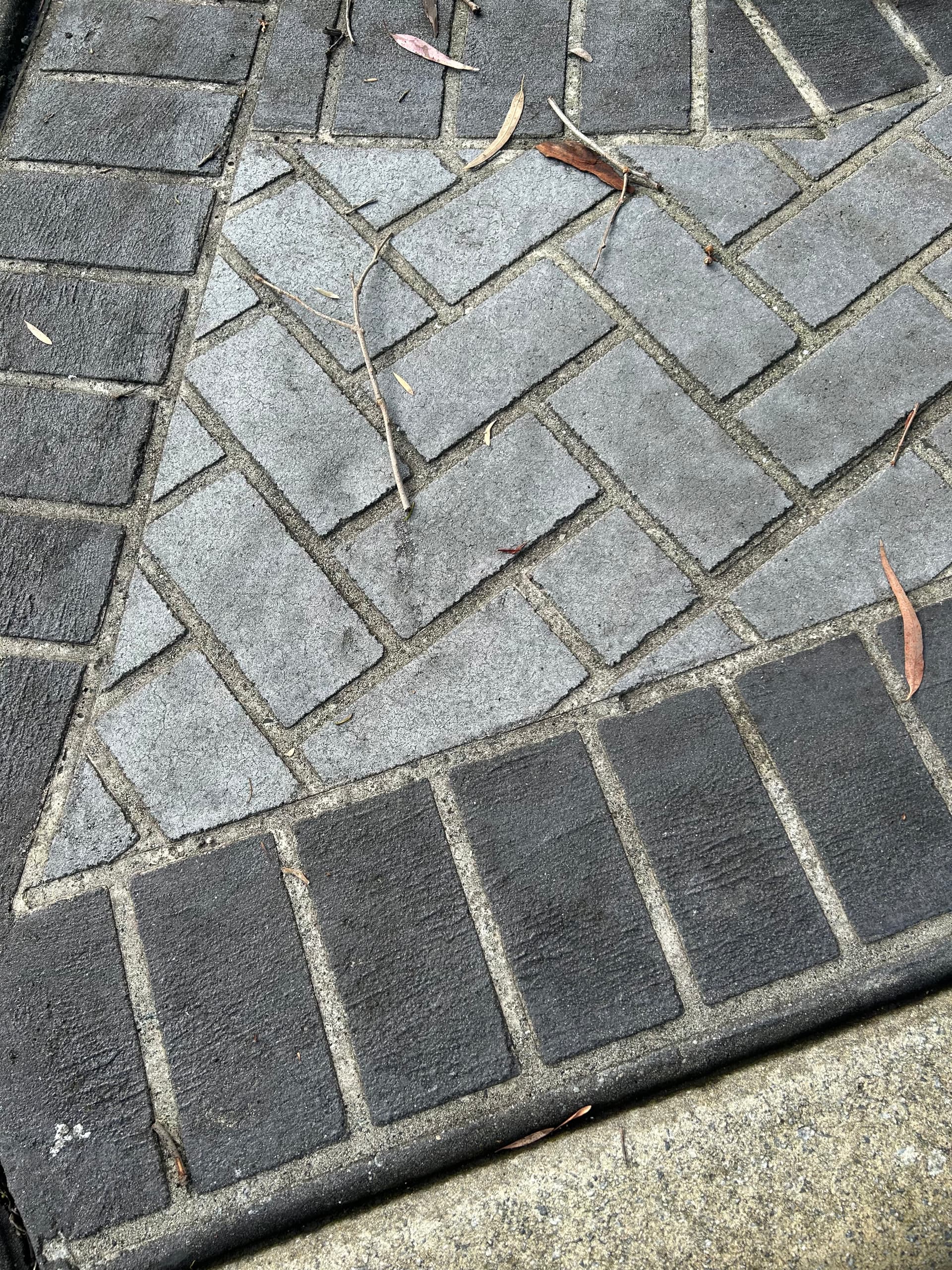
This tile no longer exists as it was destroyed as part of works that were undertaken to its pinned location in a car park. The non-existence of this tile is verified to an extent by the current wayspot photo being more than 10 years old (i.e. no further updated photos submitted since). In addition, there should be a lack of AR uploads apparent in your records for this wayspot.
Using map view, you will have difficulty in verifying to your satisfaction the continued existence (or otherwise) of this tile due to the small size of the object in question.
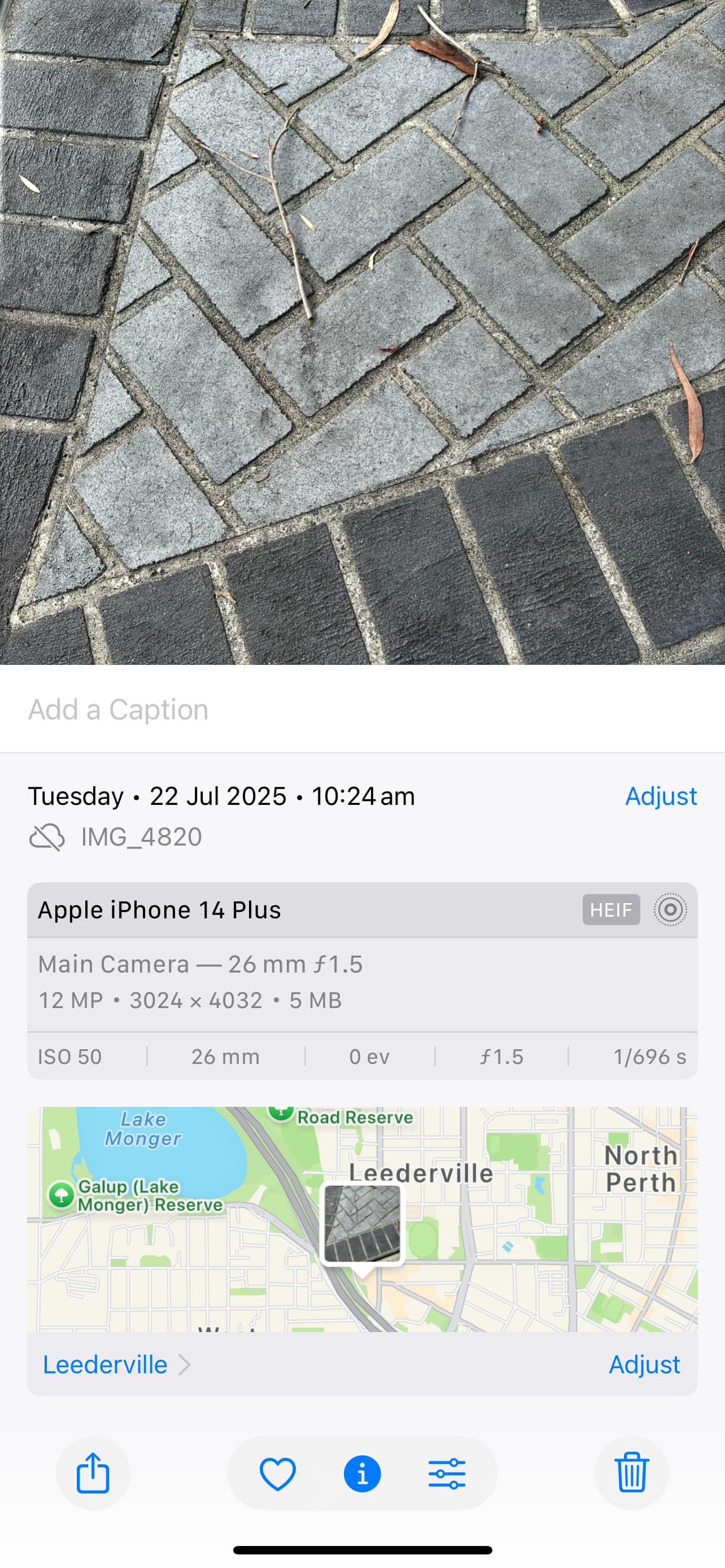
I have provided a current photo of the pinned wayspot location (which is now just a footpath).
I request that you reconsider your previous decision not to remove this wayspot.
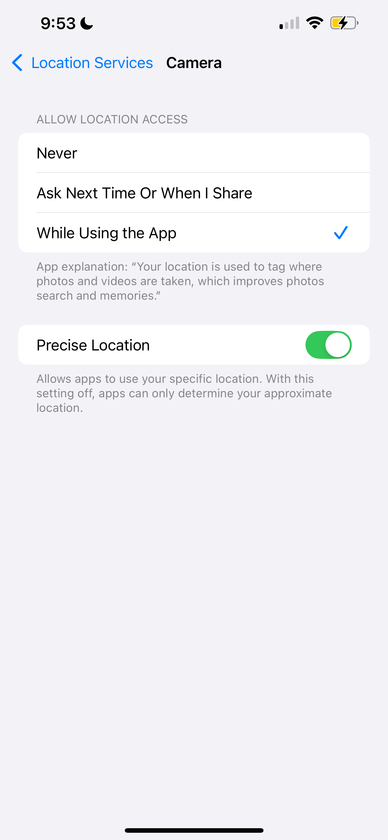
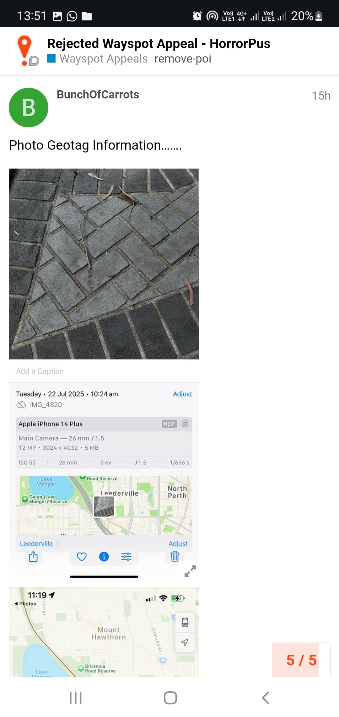
I am curious. Did you use the new option to send a photo with the report? If you did, are your photos geotagged? I don’t mean by a separate app, as was suggested you use. I am trying to find out if the team that looks at the removal reports sees the geotag on photos sent this way.
(Agree you do need to give evidence to the team that your new photo is in the location where the Wayspot is pinned. It is very difficult to reconcile your new photo with the old Wayspot photo to confirm the location is the same.)
thank you so much for answering my questions. i don’t want to put anything else on my phone, but it appears i will need to install one of those apps that puts the coords on the photo if they couldn’t see the tag
I received a email response to 5 reports over a 16 minute period (refer screenshot). Assuming my reports were the only reports that were assessed by the Wayfarer team during this period, then each report was considered for about three minutes each. Is this sufficient time to consider a request (I don’t know) … perhaps the photo geotags are not readily visible at their end.
Note - This is not a complaint as I really appreciate the work that the Wayfarer team do.
3 minutes seems like plenty of time to look at details of a report, compare to streetview/satellite/whatever and decide whether the report is correct. That doesn’t mean the decision will be always correct, but that does allow enough time to make a reasoned decision.
Agreed. It was more a commentary on whether or not the photo geotag details were considered (particularly given that two of these emails were received at the same time of 8:00 pm).
Not sure it is clear whether the GPS data that is stored as part of the exif data is carried over when uploaded. This is why it is recommended to use the app to take the image as it becomes part of the photo itself…
The geotag data for an IPhone photo shows the pinned location on Apple Maps of where a photo was actually taken. You then need to click further in to get the actual GPS co-ordinates.
I would therefore assume that the Wayfarer Team are unable to access such information unless they are using some form of Apple app.
You have shown us an image focused on that location as evidence that that tile has been removed, but it may be difficult for staff to discern. It is surprisingly common for Wayspot on road surfaces to be inaccurate in location. It would be better to present an image that would give us confidence that the tile was definitely removed.
Using the application you both indicated, I would suggest that you move a short distance away from where the way spot is designated and take a photo that shows the surface of the subject and the landscape.