Hello, I am once again asking for some
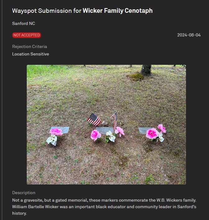
advice. I have submitted this spot a few times just because I feel this would make a great way spot. This spot is in a Cenotaph (graveless memorial) for WB Wicker and his family. Any advice is appreciated!
Hello,
It would be good to include in the description why this family was of importance to the area, not just in the supporting info.
Also, I’m not finding this on Google Maps or doing a search. Are you able to share the location?
It’s in a new neighborhood in Sanford North Carolina. You should be able to find it on google maps by typing in the “wicker cemetery”
Nope, nothing came up when searching by that. Not even searching for WB Wicker in general. Your nomination should have a location listed.
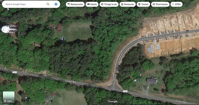
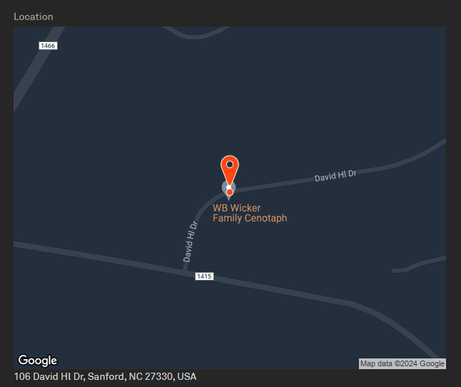
Here’s where it is. The red circle is the nomination. These use to be graves for the wickers but were moved due to the neighborhood coming up.
You must be using a map app that isn’t Google Maps, as it’s not listed there.
I also wonder if it’s on private property, with that home to the west.
It’s on Apple Maps. So the houses are private property but the land the nomination is on is public property. It’s actually along side a walking trail.
Apple Maps isn’t used by Wayfarer, only Google Maps is. Google Street View does have this at 35.56763799346701, -79.16262619794173, near the new development on David Hill Dr.
It’s not a sensitive location, and it can be accessed by pedestrians. I even see the gate on Street View that allows people to enter the enclosure. I would maybe include the new neighborhood in the supporting photo, to show it’s not in a sensitive location.
Cenotaph may not be a term many understand, so you may want to describe it better in either the description or supporting info. I had to look the word up, and it is described as a graveless monument/memorial.
Okay I will make the supporting photo include the new neighborhood and include that it’s open to the public including a gate for access. I will also include how reviewers can see it. I will probably change it to “memorial” instead of cenotaph.
Well I got another disagreement. Darn. But I learned a new word.
You had pinned the nomination incorrectly so that it was in someone’s yard. I moved it to where you could see it on street view.
I would rearrange to explain that this is not a grave first thing. Maybe the description could be “Not a gravesite, but a gated memorial, these markers commemorate the W.B. Wickers family. William Bartelle Wicker was an important black educator and community leader in Sanford’s history.” I don’t think the other stuff needs to be in the description.
For the supporting I would say something like: "Preserved historical site. A cenotaph means the remains are not here. This can be seen on Street View from David Hill Drive. Link about W.B. Wickers: Black History Past, Present and Future | Visit Sanford NC.
If you have any link to proof that these are empty, add that link.
Memorial sites themselves can be rejected as sensitive as well as graveyards, so if you can find any other way to prove this has historical value, add it.
The good news is that I saw your footbridge was a live Wayspot on the nearby when I reviewed this.
Yes it was accepted ![]() I will also include these in my next nomination. Thank you! All this information is so helpful!
I will also include these in my next nomination. Thank you! All this information is so helpful!
Also
I didn’t even realize I had it in the wrong spot! I was walking when making this nomination. Thank you!
that makes sense. it picked up where you were along the road and the area doesn’t show under the trees on satellite view, so you might not have noticed. but be sure to check where the pin is set in the nomination screen. it did not look like you were trying anything funny, just that it was off, and people may have just not looked a bit down the street.
Can you show that the gravestone really is WB Wicker? There is a wicker family cemetery in Sanford also.
I saw that there is an elementary school named after WB Wicker, which attests to the person’s importance in the community, so perhaps you could add that. But note existing gravesites that are on private property can’t be moved without the families permission, which is probably why these are still where they are. Family members must have access to the gravesites, but that doesn’t make them necessarily publicly accessible.
With the fence around it and no signs it might be difficult to convince the community that this is in fact and memorial site specifically for the Wicker family that is open to the public, rather than a private cemetery for the family. Any additional evidence that you can provide for that would be helpful.
And just for clarity, the Wicker family cemetery is not where this small fenced in area is it’s a completely separate place.
It was technically apart of the wicker family cemetery. But it’s father from
Where you see it on the map
Quite a long ways actually. Can you get a closer shot of the actual headstones to get the names?
I am once again asking for your help. Its still being rejected. I have noticed there is now a monument tag where the way spot is.
If it was not accepted in community voting with that write up, I personally would give on on getting this accepted by the community. I would probably appeal this though, explaining the significance of leaving this historical acknowledgement while developing the new neighborhood.
However, the tool tip for sensitive location does mention “memorial sites” as I said earlier, so they may choose to reject it as well, so no promises that the appeal will be accepted.
Anyone could add such a tag to Google maps.
You still have a generic photo of three stones. There is nothing showing this is in fact a memorial site for the people you mentioned. You need a close up of the names. But, as @cyndiepooh said, I would probably give up on this one. The burden is high to demonstrate that it is a memorial site for people you say and that it is meant to be open to the public.


