


I was recently able to get a similar recreation area to this with no sign in a different part of town accepted by the community at the second attempt by presenting the information in this way. However, it wasn’t enough this time. Should I try moving more of the details from the supporting information to the description?
First, congratulate yourself for taking a photo of a natural area that ML did not reject! When I get these signless parks accepted, it usually has a bench I can focus on as a visual anchor for my main photo.
Do you have any links that you can include in the supporting information (or the appeal) to prove that this is an outdoor recreation area maintained by the local council?
Thank you for your reply.
The other recreation area I nominated also made it past ML, but was initially a community rejection when I tried to anchor it to a bench and then it got rejected due to " generic business". In the successful nomination, I downplayed the existence of the bench.
Unfortunately, the council do not explicitly mention this recreation area on their website, because they only reference the ones with play equipment.
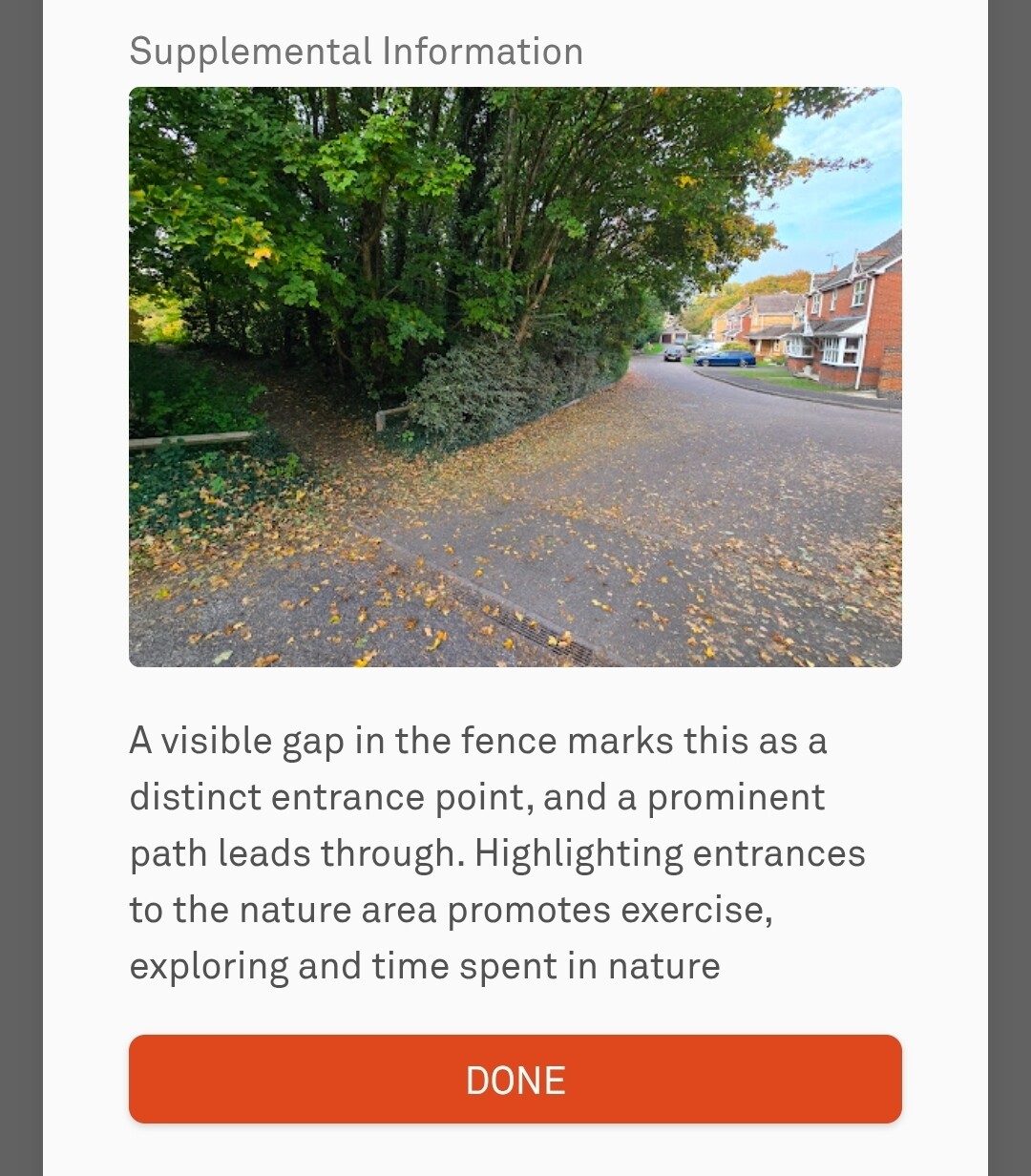
I would have used the supplemental photo as the main one.
I swapped the photos around and the resubmission got rejected by ML, so in that respect the original photo order was better.
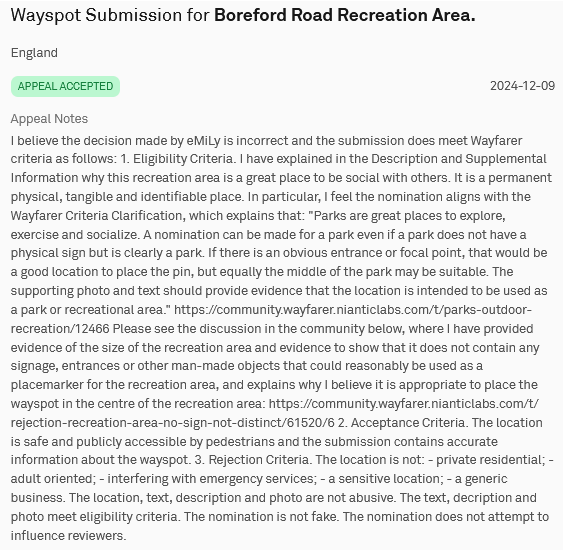
I’ve appealed this decision. Here is the text I have used in case this helps anyone else:
"I believe the decision made by eMiLy is incorrect and the submission does meet Wayfarer criteria as follows:
-
Eligibility Criteria.
I have explained in the Description and Supplemental Information why this recreation area is a great place to be social with others. It is a permanent physical, tangible and identifiable place. In particular, I feel the nomination aligns with the Wayfarer Criteria Clarification, which explains that:
“Parks are great places to explore, exercise and socialize. A nomination can be made for a park even if a park does not have a physical sign but is clearly a park. If there is an obvious entrance or focal point, that would be a good location to place the pin, but equally the middle of the park may be suitable. The supporting photo and text should provide evidence that the location is intended to be used as a park or recreational area.”
Parks & Outdoor Recreation -
Acceptance Criteria.
The location is safe and publicly accessible by pedestrians and the submission contains accurate information about the wayspot. -
Rejection Criteria.
The location is not:
- private residential;
- adult oriented;
- interfering with emergency services;
- a sensitive location;
- a generic business.
The location, text, description and photo are not abusive.
The text, decription and photo meet eligibility criteria.
The nomination is not fake.
The nomination does not attempt to influence reviewers."


The problem with the above guidance cited by the appeals team is this is an open plan recreation area (3,000+ square metres / 34,000+ square feet), adjoined by footpaths with no boundaries on three sides so no entrance points are required and there are no signs or seating.
North-west corner:

South-east corner:

North-east corner:

South-west corner:

In this instance, I believe the guidance in the criteria clarification is appropriate, namely “the middle of the park may be suitable”.
How about getting supporting photo where there is some activity to prove that its recreational area. Right now its like open field, it barely looks like park.
It’s interesting you mention that, because originally it took me ages to get photos without people in them (walking dogs / playing ball games). I am not sure whether ML is capable of detecting activity and then deciding that’s a good thing?

Hey,
Sorry you’re still having trouble with this space.
It seems similar to what I was submitting a few weeks ago, although this one is mentioned by our council despite having no playground. It has 2 entrance signs, but the area is huge, so I had wanted to highlight some of the other prominent entrances.
Other signless parks I’ve tried have had mixed results including from thr appeals team, who almost always want a sign. This appeal was initially rejected but overturned on the forum.

Thanks for the info. I’ve appealed again (I had three nominations that were rejected - the last two were exactly the same apart from the main and supplemental photos being reversed), but this time I have linked to this thread in response to the appeal rejection reasons. Annoyingly, VOWHDC do not acknowledge the existence of this recreation area on their website although their mapping indicates that they clearly maintain it.
There is the Abbey Fishponds Nature Reserve in another part of the town which can be accessed from different paths.
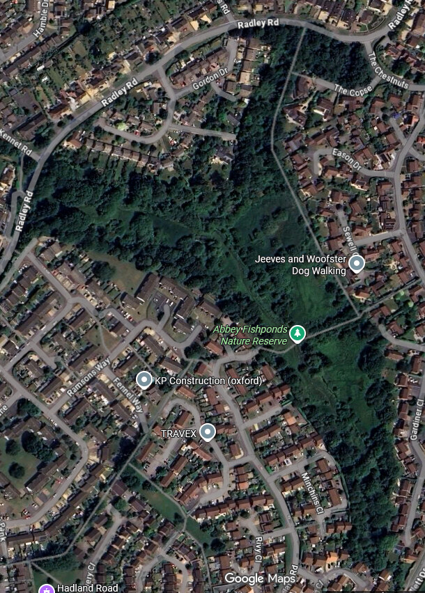
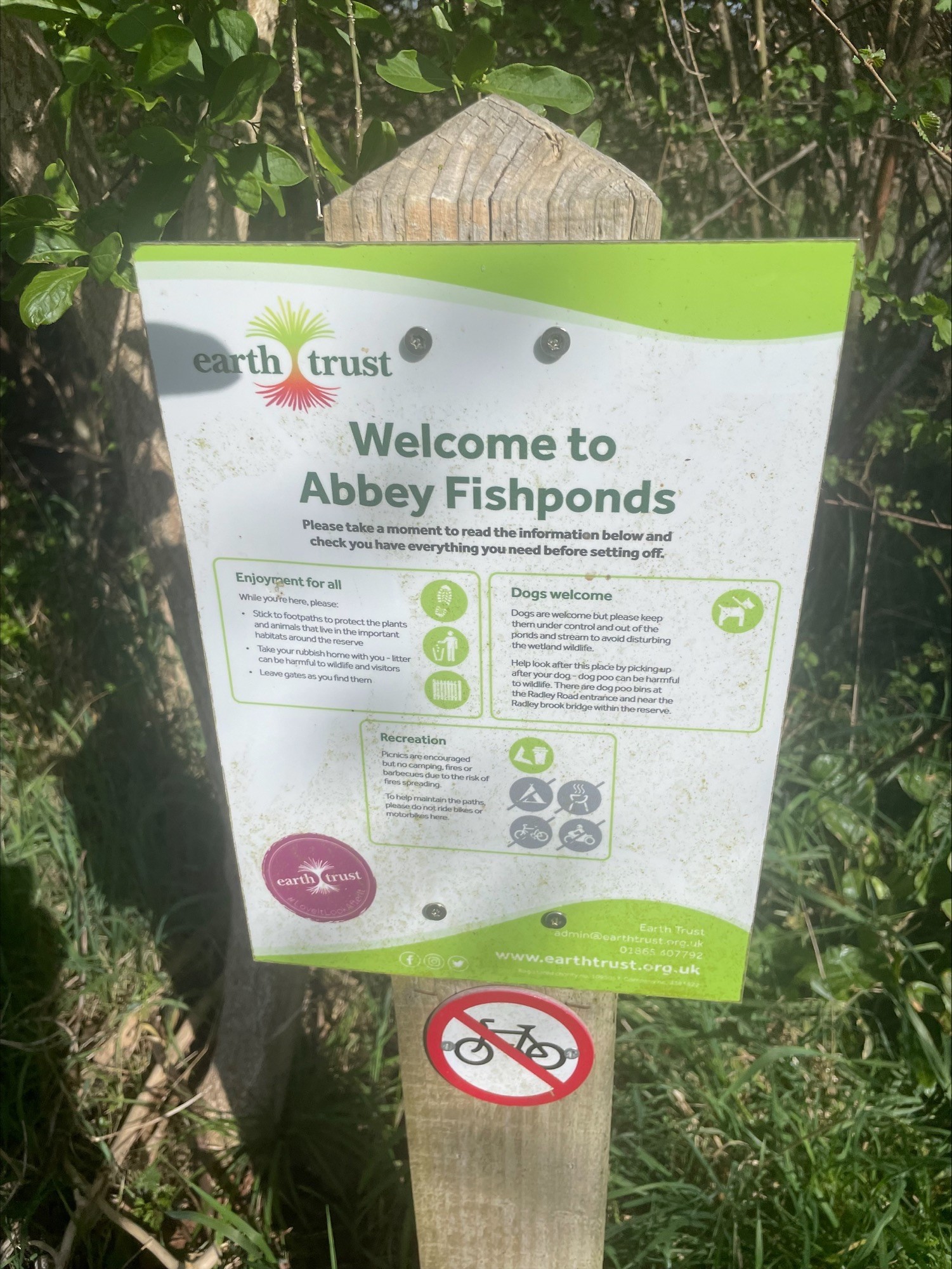
It has three wayspots. Two are on welcome signs next to the north-west and western entrances and the third one I managed to get successfully nominated on a footbridge over the stream through the middle of the reserve.
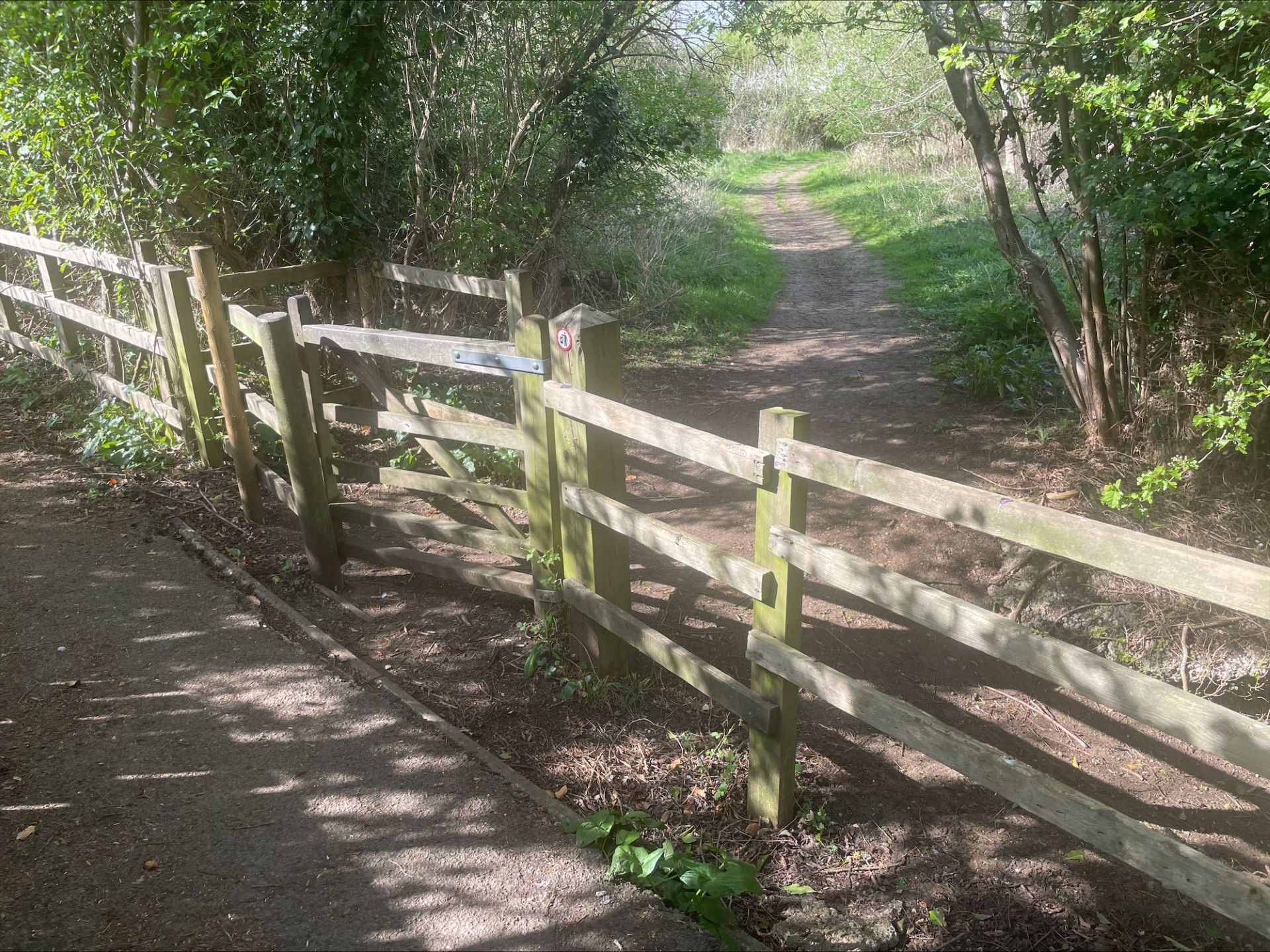
There are three other entrances (north-east, east and south), which do not have welcome signage. I did ask Earth Trust about whether they were intending to install welcome signs, but they didn’t come back to me after their initial acknowledgement. The southern entrance has post and rail fencing and a gate where it would be relatively straightforward to attach another welcome sign.
However, based on what you are saying, that may not be necessary in order to get a wayspot accepted.
The fence and gate looks like a distinct entrance point that I’d definitely submit ![]()
Oooh congratulations ![]()